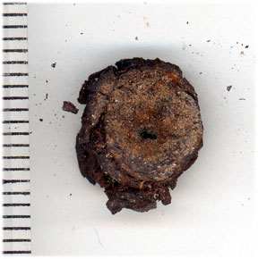
A bit of history -- I'm organizing my files to start serious work on a comprehensive report on Nikumaroro archaeology. For purposes of historical reference, I thought it might be useful to post this paper, written after the 2001 expedition to Nikumaroro. Of course, we've learned a lot about the Seven Site since this was written. And incidentally, we turned out to be wrong about the "
Kanawa" at the Triangle Site; it's not
Kanawa at all, but Island Walnut.
TK
SEARCH FOR THE
NIKUMARORO CASTAWAY’S CAMP:
PRELIMINARY
REPORT ON ARCHAEOLOGICAL INVESTIGATIONS
AT THE
TRIANGLE SITE AND THE SEVEN SITE,
NIKUMARORO
ISLAND, PHOENIX ISLANDS,
REPUBLIC OF
KIRIBATI
Thomas F. King
September 22, 2001
Introduction
Gerald Gallagher, in his 1940-41 reports to the Western
Pacific High Commission (WPHC), describes the discovery of a human skeleton and
associated artifacts which he associated with Amelia Earhart on the “southeast
corner” and “southeastern shore” of Nikumaroro (See King et al 2001:207-21 for
details). He says that the skeleton was
lying under a
Ren tree (
Tournefortia)
and that it was associated with the remains of a fire and the bones of birds
and turtle. He says that the site was
about “100 feet from high water ordinary springs.” He reports that upon discovery (prior to his
arrival on Nikumaroro), the cranium was buried; it was later exhumed at his
direction.
The cranium, mandible, and eleven other bones found by
Gallagher and his colleagues were sent to Fiji for analysis, where it was
concluded (perhaps incorrectly, according to modern reanalysis) that they were
the bones of a European or mixed-race male.
Gallagher thereupon posited that they represented the remains of an “unfortunate
castaway,” who had died within two miles of a coconut grove that could have
kept him alive.
Since several lines of evidence suggest that Gallagher may
have been right in his first assessment of the skeleton, as that of Earhart,
the site where it was found is of great interest to The International Group for
Historic Aircraft Recovery (TIGHAR).
Accordingly, two sites were investigated by TIGHAR’s 2001 Nikumaroro
IIII Expedition as possible candidates for being the “bones discovery site” or
“castaway campsite.” Field research was
completed on September 18, 2001. The
following is a very preliminary report on the two sites -–the "Triangle
Site” and the “Seven Site.
The Triangle
Site
The Triangle Site is a roughly triangular patch of apparent
pristine native vegetation on the southeastern shore of the island, surrounded
by the dense masses of te Mao (Scaevola
frutescens) typical of land that has been cleared but not successfully
planted in coconut. It was investigated
because it meets the general geographic description given by Gallagher
(Southeast shore), and because its character suggested an answer to an
otherwise rather mysterious question.
Former U.S. Coast Guardsman Floyd Kilts reported in 1960 that he had
been told about a discovery of bones on Nikumaroro, which the island’s “Irish
magistrate” had associated with Earhart (c.f., King et al 2001:54-6). Since we now know that Gallagher was
instructed to keep the discovery confidential – direction that it seems likely
he would have passed on to his I Kiribati colleagues, why did a colonist tell
Kilts about it? We speculated that if
Kilts had been involved in land clearing operations (Veterans of the Coast
Guard Loran Station on the island have told us that they did engage in such
operations), he might have been warned not to disturb the site, and told about
the discovery in order to explain the warning.
The Triangle Site was accessed from the lagoon shore by
cutting a trail into what proved to be a grove of (apparently) rather young te Kanawa (Chordia subchordata),
and then through dense te Mao to the ocean shore just west of the
site. The site itself was found to be
wooded in rather small Buka trees (Pisonia
grandis), together with te Kanawa, te
Ren, and te Uri. Elsewhere on the island te Buka have trunk diameters of up to a meter; at the Triangle Site
twenty to forty centimeter diameters were typical. This is comparable with the diameter of te Buka observed growing through World
War II-era corrugated metal at the Ameriki Loran Site.
The Triangle Site was first given a general surface
inspection by John Clauss, William Carter, and the author. Subsequently Carter and James Morrissey swept
the site with metal detectors and raked the surface clear of surface litter,
permitting close visual inspection. The
only human association found, besides contemporary flotsam in the shorefront
vegetation, was a single 30 caliber rifle or carbine cartridge. Without anything of evident interest to
investigate, and in view of the pressing need to devote resources to the Seven
Site (See below), the Triangle Site was not investigated further.
The Seven Site
Introduction
The Seven Site –so named because it abuts a natural clearing
in the
te Mao that has the shape of a crude numeral “7” – also lies at
the southeast end of the island.
Strictly speaking it is on the north shore of the southeast end, not on
the southeastern shore, but there is no reason to assume that Gallagher felt
compelled to report such fine distinctions.
Airphotos show that the Seven Site vicinity was cleared in 1941, about
the time Gallagher would have been conducting the “intensive search” of the
bones site that the High Commissioner’s office told him to carry out. Paul Laxton (1951) says that in 1949 there
was a “house built for Gallagher” on land cleared from the lagoon to the ocean
shore in this vicinity. A land parcel at
approximately the location of the Seven Site was reserved for government, or
for Gallagher himself, on maps of land divisions as late as the 1950s, over a
decade after Gallagher’s death
.
The Seven Site first came to TIGHAR’s attention through
reports by former members of the U.S. Coast Guard Loran unit on the island
during World War II. Dr. Richard Evans
and Mr. Herb Moffitt reported seeing a tank used as part of a water collection
device, unknown to the I Kiribati colonists, in the general area (c.f., King et
al 2001:117-8). Thinking the tank might
be from Earhart’s Electra, and represent an Earhart/Noonan campsite, TIGHAR
searched for it unsuccessfully during the 1991 expedition (c.f., King et al
2001:121-2). In 1996, after finding the
image of something that might be the tank on a 1941 air photo, TIGHAR revisited
the area and this time found the tank (c.f., King et al., 2001:151-6). The tank, about a meter square, was (and is)
made of steel, and bore the name of the Tarawa Police. Nearby were bird bones, a roll of green
asphalt siding, and a hole in the ground measuring about 1.5 meter in diameter,
together with a piece of copper hardware cloth, a 30 caliber cartridge, a white
stoneware plate sherd, and other artifacts clearly of either colonial or Coast
Guard origin. Concluding that the site had nothing to do with Earhart, TIGHAR
gave it no further consideration until the bones discovery papers came to light
in 1998. Faced now with a documented discovery
of bones in an apparent campsite on the southeast corner of the island, and the
coincidence of Gallagher’s intensive search with the photo-documented clearance
of land at the Seven Site, TIGHAR had to reconsider its dismissal of the site
from investigation. Perhaps, we thought,
the tank and other colonial-era objects were the remains of the intensive
search, in support of which a “house” might even have been “built for
Gallagher” – especially since Gallagher’s quarterly report for the end of 1940
indicates severe inclement weather.
This line of reasoning drew attention to the hole in the
Seven Site. Gallagher says that when the
bones were discovered, several months before his own relocation to the island
from Manra, the cranium was buried, apparently at the direction of Native
Magistrate Koata. Although Koata had
left the island by the time Gallagher learned of the discovery, and Gallagher
did not immediately excavate the cranium, he says in one of his initial
telegrams that “many teeth are present.”
After excavating the cranium, and the intensive search, he reports only
five teeth, all in the mandible.
Perhaps, we reasoned, the hole in the Seven Site was where the cranium
had been buried and subsequently exhumed.
Perhaps “many teeth” had been present in the cranium when it went into
the ground, but not when it came out. If
this were true, these teeth – excellent reservoirs of mitochondrial DNA – might
still be in the hole or its backdirt pile.
The Seven Site, and its hole, thus became a major focus of the
2001expedition.
Study Approach
Using satellite
imagery and Global Positioning Satellite (GPS) navigation, we cut through the te Mao from the lagoon shore to the “7”
– a long-persisting natural clearing – and then backtracked to find the hole
and tank. These features were separated
from the “7” by about thirty meters of very dense te Mao. We began clearing
along a ten-meter front, beginning at the outward (southern) tip of the “7’s”
top member, proceeding southerly.
Clearing was accomplished using chainsaw, bush knives, loppers, and much
tedious hauling and piling of green and dead te Mao. Cut material, which
developed into quite major piles, was heaped in the “7” itself. Reaching the tank, we widened the cut to
about twenty meters to clear its vicinity and that of the hole. Later another cut was made to the west to
open up whatwe called the Morrissey Locus after its discoverer, expedition
medic Jim Morrissey.
As clearing progressed, the topography of the site, hitherto
obscured by the vegetation, became clear.
Just south of the “7,”and more or less parallel with its long limb, is a
low ridge with a maximum elevation of about 3.5 meters above sea level. The ground drops off to the south-southwest,
about a meter, to the level of the tank and hole. It then continues to drop gently to the
lagoon shore, a total distance of about 200 meters from the ocean-side high
tide line. The microclimatic difference
between the ridge and the tank/hole vicinity is marked. Temperatures at the site routinely ran in the
high 90s (f), and temperatures of 110 degrees (f) were not uncommon, even in
the shade, but the prevailing trade winds kept the ridge relatively pleasant
while the tank/hole area was always baking hot.
The ridge also benefited from the presence of several
good-sized te Ren and te Uri. About fifty meters northwest of
the "7” a stand of large, apparently old-growth te Buka begins, which runs for perhaps half a kilometer up the
spine of the island. Air photos suggest
that this forest may have extended across the Seven Site (though not across the
“7”) in 1938.
Because the ridge was so (relatively) pleasant, it naturally
became the place to which team members gravitated to cool off during rest
breaks. This led to the discovery of
fish, bird, and turtle bones just under the forest-floor duff, together with an
elongate cluster of giant clam (Tridacna gigas) valves. Since Gallagher had described the bones
discovery site as including the remains of bird, fish, and turtle, the ridge
naturally became an important focus of our attention.
Eventually, we excavated and/or carried out intensive
surface examinations in five loci – the Hole Locus, the Tank Locus, the Ridge
Locus, the Slope Locus, and the Morrissey Locus. At each locus, work was carried out under
tarpaulin sunscreens constructed by expedition medic James Morrissey, which
proved remarkably capable not only of making work bearable in the blazing sun
but of standing up through frequent gusty rain squalls. In addition to controlled work in specific
loci, all cleared areas were mapped and swept with metal detectors, and a good
deal of informal reconnaissance was done in the te Mao to the southeast and the te
Buka forest to the northwest.
Reconnaissance was also carried out for comparative purposes at the
Ameriki Loran Station Site, at Karaka Village on Ritiati, and among the house
sites on the Nutiran shore.
Reconnaissance was also carried out along the lagoon shore, and along
the route of an apparent trail that appears in a 1938 air photo between the
Seven Site and the lagoon.
Descriptions and preliminary observations are provided
below, organized largely by locus.
Hole Locus
After surface mapping and photography, -- during which a
white stoneware plate sherd decorated with the U.S. Coast Guard emblem was
found and recovered -- the backdirt pile from the hole, which was quite evident
to the south and southeast of the hole itself, was excavated and passed first
through ¼” and then through 1/8” screen. It should
be said, however, that much of the material both in the Hole Locus and
elsewhere did not pass through the screen at all, since it comprised
finger-sized to fist-sized pieces of coral rubble. The hole and its backdirt were particularly
rubbly, with a very light humic content.
Once the backdirt pile had been removed, the same system of excavation
was applied to 2 x 2.5-meter rectangle enclosing the hole itself, subdivided
into quarters. All material caught in
screens was carefully inspected by daylight, and everything that passed the ¼”
screen but was caught in the 1/8” was inspected under ultraviolet (UV) light
during two overnight sojourns at the site.
Bones and teeth fluoresce in UV light.
All work at the Hole Locus was supervised by forensic anthropologist Dr.
Karen Burns, with Mr. Gary Quigg and various associates doing the digging.
At 50 cm.
,
the depth of the hole’s surface expression, the excavation unit floor was
scraped and revealed what appeared to be evidence of two pits – one coincident
with the original hole, the other slightly to the southwest of the first. Both were filled with coral rubble and very
little humus, while their surroundings were somewhat more humic and made up of
smaller rubble fragments. The second pit
could also be seen in the south and west sidewalls of the excavation. In subsequent levels the two pits seemed to
coalesce, and at 80 cm. they disappeared altogether.
No human bones or teeth were found, but fish and bird bones
were sporadically recovered from about 40 cm. downward, sometimes associated with
small rust flakes. Several bird and fish
bones appeared in the very deepest level excavated (90-100 cm.). At this point, we decided that however
intriguing these bones might be, they were not likely to be relevant enough to
our research to justify further work.
The excavation was clearly marked for future reference, partly
backfilled, and closed down.
The Tank Locus
The Tank Locus, at the southern base of the ridge slope, of
course contains the tank – a 99 x 99 cm.
steel box with “Police X Tarawa” hand-lettered on two opposing sides. Collapsed inside the tank is the heavy steel
rim for a dogged hatch, the hatch itself (labeled “Baldwin Tank Co., London”)
lying on the ground outside. Coconut
shell halves first noted in 1996 also were found in the tank. Two holes in the tank, filled with bolts,
nuts, and washers, recall a story told TIGHAR just before departure by an
ex-Coast Guardsman, about a tank shot through by one of his companions, that
had to be patched because the colonists were still using it. The holes, with their surrounding metal and
contents, were collected by Skeet Gifford for analysis.
Very similar tanks were recorded in the village at the Rest
House, at the Carpenter’s shop, and at what may have been the dispensary. In each case (except possibly at the
Carpenter’s shop, where the tank may simply have been in storage), the tanks
were used to collect rainwater from the buildings’ roofs. In the case of the possible dispensary,
Christopher Kennedy was able to demonstrate that the tank still contained
water, which still ran out of a spigot at the bottom when the latter was turned
on.
Adjacent to the tank at the Seven Site, to the west, were
two wooden posts and a rust field that clearly represented corrugated
iron. Mapping suggested that this
feature represents a collapsed iron-roofed structure, whose roof drained
rainwater into the tank.
South of the tank was a rather extensive scatter of bird
bones, first noted in 1996. These were
mapped and collected.
In 1996 the base of a light bulb was found near the
tank. In 2001 two more pieces of this
bulb were found. Other artifacts in the
Tank Locus included screening scraps, pieces of wire, a plate sherd with a blue
line near its rim (much like a line on the U.S. Coast Guard plate sherd found
in the Hole Locus), and 30 caliber shells.
The Ridge Locus
Three 2 x 2 meter and one 1 x 2 meter units were intensively
surface-collected and excavated on the crest and north face of the ridge. Two surface features outside the excavation
units were also investigated, together with a number of metal detector
hits. Each excavation unit was dug in 1
meter quadrants, with all “soil” passed through ¼” and then 1/8” screen. The “soil” was uniformly dominated by coral
rubble, but with a considerable admixture of humus. Each unit was excavated to 10 cm., and then
the most productive quadrant was taken to 20 cm. Invariably, the 10-20 cm. levels were
virtually devoid of bones or other cultural material. All bones and plates were collected by level
and quadrant, together with a sample of the very numerous scales.
The Ridge Locus produced a large amount of bird, fish, and
turtle bones, together with turtle shell plates and fish scales, in several
discrete concentrations. Some of the bone was clearly burned, and small flecks
of charcoal were noted. One of the
concentrations also contained an odd folded piece of green asphalt siding,
identical with the roll of such material found in 1996 about ten meters to the
southeast along the ridge. The siding is
folded around what appears to be a felt-like fabric. A similar but more deteriorated artifact was
found about two meters from the first.
Slope Locus
This locus comprises the ridge slope southeast of the Ridge
Locus and upslope from the tank. Metal
detector sweeps resulted in multiple hits here, whose excavation revealed not
only the usual rest flakes and 30 caliber shells, but also pieces of glass and
some enigmatic electric or electronic components. A single
2 x 2 meter unit was excavated here, and a single external feature was
mapped but not recovered. The excavation
was done in the usual way, except that only ¼” screen was employed.
The excavation unit was devoid of cultural material except
in its southeast quadrant, where many fish and bird bones were found. There is evidence of another burn feature
just upslope, which can be seen in the profile of the unit’s east and south
walls.
Upslope to the southeast, on the other side of the apparent
burn feature (which supports a vigorous growth of te Mao), a second Tridacna feature was cleared and recorded
but not removed. As in the first such
feature, some fifteen clams were represented by about thirty valves, in an
elongate cluster. Some of the clams were
somewhat larger than those in the first feature (up to about 30 cm. long), and
only one or two were broken as though bashed with a rock. Associated with this feature were a ferrous
cap for some kind of container, two odd screw-mounted clips, a strip of
small-mesh copper screen (common all over the site), and a 40 x 40 cm.
rectangle of rust, apparently either a sheet of iron or a collapsed metal box,
with what look like rivets or studs along one edge. All these associations were collected except
for the last, from which only the pieces with stud- or rivet-like bumps were
recovered.
Several other pieces of copper screening were found on the
surface of the Slope Locus, as well as elsewhere on the site. Other artifacts
recovered included 30 caliber cartridges, the cut-off end of a battery cable, a
small apparatus that may be an electronic component, and three pieces of
glass. Each of the last is of a distinct
kind of glass, and two show edge flaking that may represent use as tools.
Preliminary Interpretation
At least three distinct sets of human activities are evident
at the Seven Site, which may or may not be related to one another.
The ubiquitous 30 caliber and (much less common) 22 caliber
cartridges almost certainly represent recreational shooting by Coast Guardsmen
during World War II. The plate sherds
may also reflect this activity; tossed into the air, they would make good
skeet-like targets. Some of the bird bones, notably those in the Tank Unit, may
represent a similar use of birds as targets.
The tank and its associations, probably the ferrous sheets
and asphalt and asbestos siding, and the hole are probably the results of work
done at the site by I Kiribati colonists.
The kinds of work involved remain mysterious. The tank and its
associated structure, and the hole, are consistent with our hypothetical
identification of the site as the location of Gallagher’s intensive
search. The structure by the tank may
have been the “house built for Gallagher,” though there are questions to be
resolved about this interpretation. The
extensive sheet metal features, asbestos siding fragments, and rolled asphalt
siding have no obvious relevance to a search operation. The sheet metal, at least, probably arrived
at the site sometime after 1946, when large amounts of it became available with
abandonment of the Loran Station. The
asphalt siding may have arrived earlier, since it underlay the sheet metal and
has been found elsewhere only in thevillage, not at the Loran site. The asbestos siding is identical to that
found on the cistern and cookhouse, among the village’s oldest buildings. The copper screening also seems most likely
to be of colonial origin; identical screening was found in the village and on
the Nutiran shore, while only screening of a smaller gauge was found at the
Loran site.
Of most interest, of course, are the several (at least six)
deposits of burned and unburned fish, bird, and turtle bones, together with the
two Tridacna features and the small bivalve feature. Clearly these represent someone’s use of
local food resources, probably for subsistence, but who the user or users may
have been remains to be determined. At
least the following possibilities exist:
Ø Prehistoric
or historic period voyagers from other islands (e.g., Manra or Orona, which
supported populations in prehistoric times), visiting Nikumaroro to fish and
hunt.
Ø PISS
colonists.
Ø Coast
Guardsmen.
Ø The
castaway or castaways.
There is some reason to think that the last possibility is
the most likely. The lack of evidence
either of traditional earth oven (umum)
cooking or of post-contact cooking pots tends to argue against traditional or
colonial-period Polynesians or Micronesians as the ones responsible for the
burn features. It is difficult to
imagine Coast Guardsmen doing much cooking of local fauna on the site, and one
would expect such an activity to have produced more World War II-vintage food
and beverage containers than we have thus far noted. On the other hand, things like the possible
flaked-glass tools suggest adaptation of available tools to serve subsistence
needs – something that is very much to be expected of a castaway. All this is speculative, however, and
requires much more analysis.
Ø To
sort out the history of the Seven Site, and assign its component parts to their
correct periods and functions, will require at least the following further
work:
Ø Documentary and interview research. We badly need to get a better understanding
of what happened at the Seven Site during the late 1940s and 1950s. Documentary data on colonial activities
during this period should be available in the files of the WPHC at Hanslope
Park and at the Kiribati National Archives in Tarawa. There should also be people living who were
residents of the Nikumaroro colonial settlement during this period, probably in
Kiribati itself, perhaps in Tuvalu, and certainly in Nikumaroro Village in the
Solomon Islands. Research visits to all
these locations, conducted by qualified people with sufficient time to do their
work, would be very worthwhile.
Consultation with veterans of the U.S. Coast Guard Loran Station about
their activities at the site should be relatively easy, particularly since a
number of these veterans are TIGHAR members or participants in the Earhart
Forum.
Ø Faunal analysis. The fish, bird, and turtle bones, plates, and
scales, and the bivalves, must be analyzed to find out a number of things, such
as:
Ø How
many individuals are represented?
Ø What
species are represented?
Ø Where
and how easily could they have been procured?
Ø How
were they prepared and cooked?
Ø What
parts were used and not used?

 As for airplane parts,
those we’ve found have mostly been on residential sites, where they were
probably dropped in the course of transforming them into hair combs, fish
lures, inlay for boxes, and the like. Residential sites are distributed mostly
SE of the Government Station, an area that’s densely wooded in feral coconut
and pandanus (producing a thick, obscuring mat of deadfall on the ground. So
we’re planning a simple sweep with metal detectors of a swath starting at the
dispensary and proceeding east to the lagoon beach, to see what may be
detected. Anything that appears to be aircraft-related will be located using
GPS and collected if feasible.
As for airplane parts,
those we’ve found have mostly been on residential sites, where they were
probably dropped in the course of transforming them into hair combs, fish
lures, inlay for boxes, and the like. Residential sites are distributed mostly
SE of the Government Station, an area that’s densely wooded in feral coconut
and pandanus (producing a thick, obscuring mat of deadfall on the ground. So
we’re planning a simple sweep with metal detectors of a swath starting at the
dispensary and proceeding east to the lagoon beach, to see what may be
detected. Anything that appears to be aircraft-related will be located using
GPS and collected if feasible.